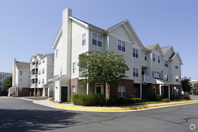
Property Record
2150 Astoria Cir, Herndon, VA 20170

NEARBY LISTINGS FOR SALE OR LEASE
-
-
View all Herndon listings for sale on LoopNet.com
Property Detail
2150 Astoria Cir
Washington-Arlington-Alexandria, DC-VA-MD-WV
Dulles Greens
0161-01-0005B
DULLES GREENS LAND BAY 1
Apartment
Fairfax
X
Virginia
51107C0385E
5b
2024
19.21 AC
2025
Herndon
481000
Washington, DC
491,841 SF
DEMOGRAPHICS near 2150 Astoria Cir
1 Mile
3 Mile
5 Mile
2024 Total Population
18,127
102,971
222,385
2029 Population
18,087
103,873
225,732
Pop Growth 2024-2029
(0.22%)
+ 0.88%
+ 1.51%
Average Age
34
37
39
2024 Total Households
6,176
36,552
82,195
HH Growth 2024-2029
+ 0.62%
+ 0.89%
+ 1.50%
Median Household Inc
$117,990
$127,353
$133,455
Avg Household Size
2.80
2.70
2.60
2024 Avg HH Vehicles
2.00
2.00
2.00
Median Home Value
$514,965
$571,169
$627,537
Median Year Built
1997
1991
1989
Nearby Places
- Restaurants
- Banks
- Shops
- Fitness
- Groceries
PUBLIC TRANSPORTATION
TRANSIT/SUBWAY
Innovation Center, Silver Line Center Platform (Metrorail Silver Line - WMATA)
DRIVE
WALK
Distance
Innovation Center, Silver Line Center Platform (Metrorail Silver Line - WMATA)
12 min
13 min
0.7 mi
AIRPORT
Washington Dulles International
DRIVE
WALK
Distance
Washington Dulles International
12 min
4.3 mi
Ronald Reagan Washington Ntl
DRIVE
WALK
Distance
Ronald Reagan Washington Ntl
44 min
28.3 mi
Freight Ports
Port of Baltimore
DRIVE
WALK
Distance
Port of Baltimore
85 min
60.3 mi
Nearby Properties
Address
Land Use
TOTAL SIZE
Lot Size
Zoning
Address
Land Use
TOTAL SIZE
Lot Size
Zoning
2,700,000 SF
7.51 AC
PDGI
Address
Land Use
TOTAL SIZE
Lot Size
Zoning
234,124 SF
23.84 AC
PDOP
Address
Land Use
TOTAL SIZE
Lot Size
Zoning
427,320 SF
16.33 AC
PDIP
Address
Land Use
TOTAL SIZE
Lot Size
Zoning
364,600 SF
PDOP
Address
Land Use
TOTAL SIZE
Lot Size
Zoning
308,630 SF
14.44 AC
PDIP
Address
Land Use
TOTAL SIZE
Lot Size
Zoning
147,260 SF
33.04 AC
PDIP
Address
Land Use
TOTAL SIZE
Lot Size
Zoning
228,606 SF
PDOP
Address
Land Use
TOTAL SIZE
Lot Size
Zoning
180,355 SF
12.89 AC
PDIP
Address
Land Use
TOTAL SIZE
Lot Size
Zoning
764,166 SF
73.90 AC
PDIP
Address
Land Use
TOTAL SIZE
Lot Size
Zoning
226,456 SF
17.09 AC
PDIP
Address
Land Use
TOTAL SIZE
Lot Size
Zoning
1,096,572 SF
85.06 AC
110
Address
Land Use
TOTAL SIZE
Lot Size
Zoning
364,650 SF
PDOP
Address
Land Use
TOTAL SIZE
Lot Size
Zoning
169,092 SF
PDMUB
Address
Land Use
TOTAL SIZE
Lot Size
Zoning
253,352 SF
PDOP
Address
Land Use
TOTAL SIZE
Lot Size
Zoning
252,473 SF
9.03 AC
PDIP
Address
Land Use
TOTAL SIZE
Lot Size
Zoning
120,240 SF
12.15 AC
PDIP
Address
Land Use
TOTAL SIZE
Lot Size
Zoning
180,039 SF
15.98 AC
PDOP
Address
Land Use
TOTAL SIZE
Lot Size
Zoning
450,397 SF
1.07 AC
373
Address
Land Use
TOTAL SIZE
Lot Size
Zoning
128,500 SF
9.95 AC
PDIP
Address
Land Use
TOTAL SIZE
Lot Size
Zoning
332,957 SF
12.68 AC
550
Address
Land Use
TOTAL SIZE
Lot Size
Zoning
263,340 SF
79.61 AC
GI
Address
Land Use
TOTAL SIZE
Lot Size
Zoning
425,073 SF
19.02 AC
330
Address
Land Use
TOTAL SIZE
Lot Size
Zoning
357,437 SF
3.76 AC
350
Address
Land Use
TOTAL SIZE
Lot Size
Zoning
407,812 SF
33.12 AC
373
Address
Land Use
TOTAL SIZE
Lot Size
Zoning
429,038 SF
11.41 AC
400
Address
Land Use
TOTAL SIZE
Lot Size
Zoning
337,921 SF
13.57 AC
373
Address
Land Use
TOTAL SIZE
Lot Size
Zoning
396,112 SF
15.92 AC
330
Address
Land Use
TOTAL SIZE
Lot Size
Zoning
490,340 SF
18.30 AC
320
Address
Land Use
TOTAL SIZE
Lot Size
Zoning
306,224 SF
10.14 AC
R1
The World's #1 Commercial Real Estate Marketplace
Connect with us
© 2025 CoStar Group
The information above has been obtained from sources believed reliable. While we do not doubt its accuracy we have not verified it and make no guarantee, warranty or representation about it. It is your responsibility to independently confirm its accuracy and completeness. Any projections, opinions, assumptions, or estimates used are for example only and do not represent the current or future performance of the property. The value of this transaction to you depends on tax and other factors which should be evaluated by your tax, financial, and legal advisors. You and your advisors should conduct a careful, independent investigation of the property to determine to your satisfaction the suitability of the property for your needs.